
Description
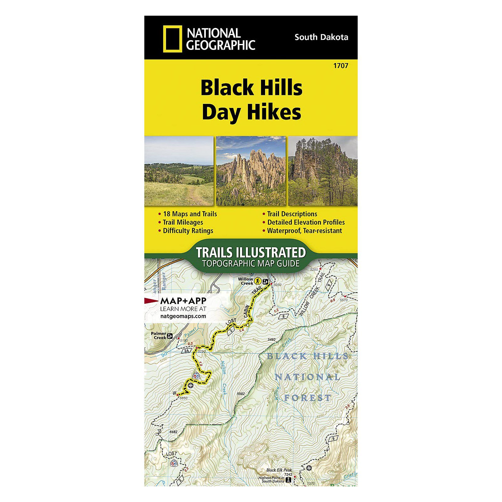
What is the Black Hills Day Hikes Map?
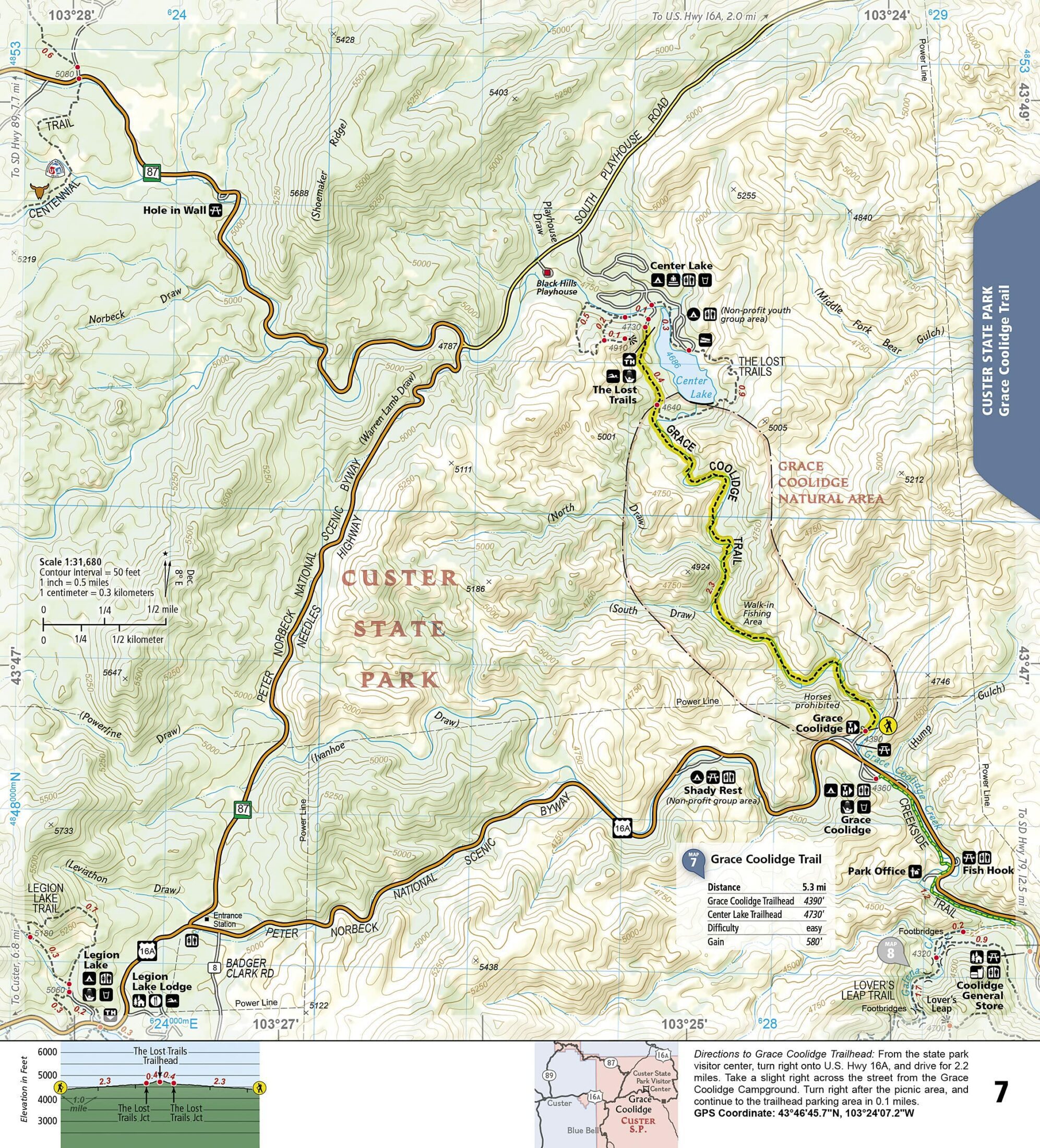
It’s a 48-page topographic map booklet published by National Geographic as part of their Trails Illustrated series (map #1707). Unlike a standard folded trail map, this is a staple-bound booklet. It covers 16 day hikes in the Black Hills, each with a trail description, directions to the trailhead, an elevation profile, total elevation gain, and distance.
The booklet is printed on National Geographic’s “Backcountry Tough” waterproof, tear-resistant paper with stainless steel staples. It handles weather and rough use in a pack without falling apart. At 3 ounces and 4.25″ x 9.38″ folded, it fits in a cargo pocket.
The hikes range from easy (Canyons Loop) to strenuous (Black Elk Peak, the highest point in South Dakota at 7,242 feet). They’re spread across federal and state public lands throughout the Black Hills.
Coverage area
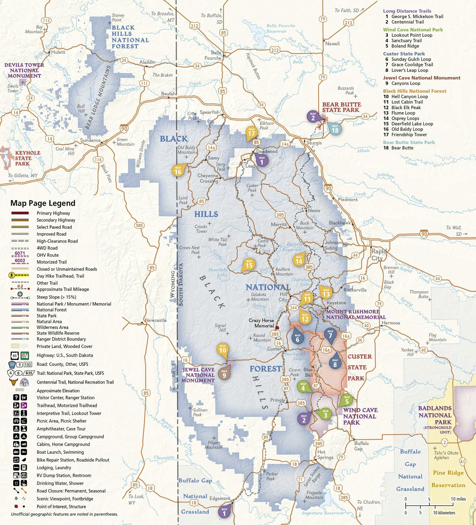
The 16 featured hikes cross five different public land units:
- Wind Cave National Park – prairie and ponderosa pine forest trails
- Jewel Cave National Monument – surface trails above the cave system
- Custer State Park – hikes through granite formations and wildlife areas
- Black Hills National Forest – forest and ridge trails, including Black Elk Peak
- Bear Butte State Park – trails on the plains at the northeast edge of the Black Hills
Two long-distance trails are also featured: the George S. Mickelson Trail (a 109-mile rail-trail) and the Centennial Trail (111 miles from Bear Butte to Wind Cave). Both can be broken into day hike segments, and the booklet shows you how.
What’s included for each hike
Every featured trail in the booklet includes:
- Topographic map at 1:50,000 scale
- Written trail description
- Directions to the trailhead
- Elevation profile showing the full route
- Total elevation gain
- Trail distance
- Full UTM grid overlay for GPS navigation
Specifications
- Pages: 48
- Format: Staple-bound booklet
- Folded size: 4.25″ x 9.38″
- Weight: 3 oz
- Map scale: 1:50,000
- Paper: “Backcountry Tough” waterproof, tear-resistant
- Binding: Stainless steel staples
- Navigation: Full UTM grid for GPS
- Publisher: National Geographic Maps (Trails Illustrated)
- Map number: 1707
- ISBN: 978-1-56695-828-8
- Published: 2022
Who is this for?
Day hikers visiting the Black Hills. If you’re planning a trip and want one resource that tells you where to go, how to get there, and what to expect, this booklet does that for 16 trails. It fits in a cargo pocket or the side pocket of a daypack.
Hikers who want waterproof maps. Standard paper maps don’t survive a full day in the Black Hills. Afternoon thunderstorms are common May through September. This map handles rain without falling apart.
People figuring out which trails to do. The elevation profiles and difficulty range make it easy to pick a hike that matches your fitness level and available time. If you only have a few hours near Wind Cave, the booklet will point you to the right trail.
Frequently asked questions
Is this a folded map or a booklet?
It’s a booklet, not a traditional folded sheet map. 48 staple-bound pages, about the size of a small paperback (4.25″ x 9.38″ when closed). National Geographic calls this format a “Topographic Map Guide.” It’s different from their standard Trails Illustrated folded maps like the Black Hills South (#238) or Black Hills North (#751).
Is the paper actually waterproof?
Yes. National Geographic’s “Backcountry Tough” paper is both waterproof and tear-resistant. The staples are stainless steel so they won’t rust. You can use it in rain without the pages disintegrating.
What trails are included?
Sixteen day hikes ranging from easy to strenuous, across Wind Cave National Park, Jewel Cave National Monument, Custer State Park, Black Hills National Forest, and Bear Butte State Park. The two long-distance trails (Mickelson Trail and Centennial Trail) are also featured with suggestions for breaking them into day segments.
Does this map work with GPS?
Yes. A full UTM grid is printed on every map page. You can take a GPS reading and locate yourself on the map using the grid coordinates.
How is this different from the regular Black Hills Trails Illustrated maps?
The standard Trails Illustrated Black Hills maps (#238 South, #751 North) are large folded sheet maps that show the full area with all roads and trails. This booklet (#1707) is smaller and focused on 16 curated day hikes, with trail descriptions, elevation profiles, and trailhead directions included. The standard maps give you more geographic coverage; this one gives you more trail-specific detail.
Can I use this for the Centennial Trail or Mickelson Trail?
Both are featured in the booklet with maps and segment suggestions. For a more detailed guide to the full 111-mile Centennial Trail, see Hiking Centennial Trail ($25.99).
Does buying this support national parks?
Yes. Your purchase through Black Hills Parks & Forests Association supports education, conservation, and visitor services at Wind Cave National Park, Jewel Cave National Monument, Scotts Bluff National Monument, Agate Fossil Beds National Monument, and the Black Hills National Forest.
Related maps and trail guides
- Trails Illustrated Topographic Map – Badlands National Park ($14.95)
- Wind Cave National Park Map Poster ($12.99)
- Hiking Centennial Trail ($25.99) – detailed guide to the full 111-mile trail
- National Geographic Guide to National Parks of the United States ($28.00)