
Real-time rates straight from USPS. No mark-ups, ever. Every dollar we don’t spend on so-called ‘free shipping’ fuels research, internships, and trail work in your favorite parks / forests.
Become a BHPFA member for $30 a year and we’ll fire a digital membership code into your inbox in seconds. Paste that code at checkout and save 15%.
Flash your membership card at hundreds of nonprofit park stores nationwide for 10% off.
Park rangers and US Forest Service interpreters hand-pick every title, tee, and trinket, so you’re getting facts not fluff. And your purchase keeps them on the front lines.
Description
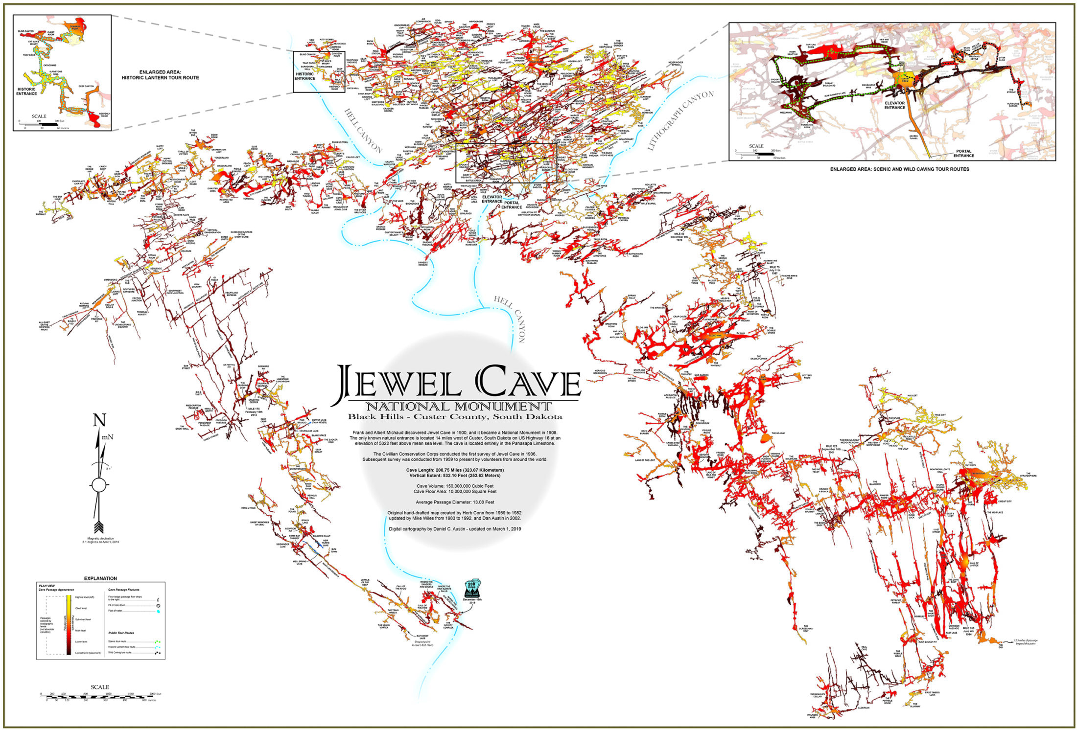
Frank and Albert Michaud discovered Jewel Cave in 1900, and it became a National Monument in 1908.
The only known natural entrance is located 14 miles west of Custer, South Dakota on US Highway 16 at an
elevation of 5322 feet above mean sea level. The cave is located entirely in the Pahasapa Limestone.
The Civillian Conservation Corps conducted the first survey of Jewel Cave in 1936.
Subsequent survey was conducted from 1959 to present by volunteers from around the world.
This map shows the entire cave complex at it’s last digital updated mileage of 219.66 Miles (353.51 Kilometers) as of February 2024. The Jewel Cave National Monument Map Poster is 24″ wide x 18″ tall.
Original hand-drafted map created by:
Herb Conn from 1959 to 1982
Mike Wiles from 1983 to 2002
Digital cartography by:
Dan Austin from 2009 to 2023
Chris Pelczarski from 2023 to 2024
Additional information
| Weight | 12 oz |
|---|