
Black Hills National Forest Recreation Map (2017 Edition)
$14.00
In stock
Shipping calculated in cart/checkout: Shipping rates for first items start at $7, calculated based on weight of total order.
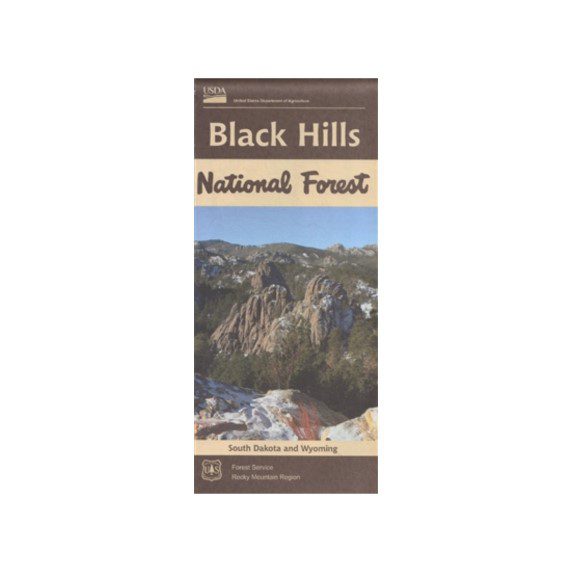
The official U.S. Forest Service recreation map for the Black Hills National Forest, 2017 edition. Folded reference map showing roads, trails, campgrounds, ranger districts, and recreation sites across 1.25 million acres of South Dakota and Wyoming forest.
- Coverage: Black Hills National Forest, South Dakota and Wyoming (about 1.25 million acres)
- Scale: 1:90,000 with shaded relief (no topographic contour lines)
- Folded size: roughly 10″ x 5″; weight 4.3 oz
- Publisher: USDA Forest Service, Rocky Mountain Region (R2)
- ISBN: 9781628111149 (2017 edition)
- Proceeds support the Black Hills National Forest and other BHPFA partner parks and forests.
In stock
60-day returns · Ships from South Dakota via USPS
Black Hills National Forest Recreation Map (2017 Edition)
$14.00
In stock
Shipping calculated in cart/checkout: Shipping rates for first items start at $7, calculated based on weight of total order.
The official U.S. Forest Service recreation map for the Black Hills National Forest, 2017 edition. Folded reference map showing roads, trails, campgrounds, ranger districts, and recreation sites across 1.25 million acres of South Dakota and Wyoming forest.
- Coverage: Black Hills National Forest, South Dakota and Wyoming (about 1.25 million acres)
- Scale: 1:90,000 with shaded relief (no topographic contour lines)
- Folded size: roughly 10″ x 5″; weight 4.3 oz
- Publisher: USDA Forest Service, Rocky Mountain Region (R2)
- ISBN: 9781628111149 (2017 edition)
- Proceeds support the Black Hills National Forest and other BHPFA partner parks and forests.
In stock
60-day returns · Ships from South Dakota via USPS
Real USPS rates, no markup. The money we save funds trail crews and internships.
Join BHPFA for $30 a year -> get your code by email in seconds. -> Use it at checkout today. Show your card at hundreds of nonprofit park stores nationwide for 10% off.
Every item is selected or approved by rangers and staff. Your purchase keeps them on the front lines.
Real USPS rates, no markup. The money we save funds trail crews and internships.
Join BHPFA for $30 a year -> get your code by email in seconds. -> Use it at checkout today. Show your card at hundreds of nonprofit park stores nationwide for 10% off.
Every item is selected or approved by rangers and staff. Your purchase keeps them on the front lines.
Description
What is the Black Hills National Forest Recreation Map?
This is the official recreation reference map for the Black Hills National Forest, published by the USDA Forest Service Rocky Mountain Region. The 2017 edition (ISBN 9781628111149) is the most recent printing in the agency’s recreation-map series for the forest. It covers the full 1.25 million acres of national forest land across western South Dakota and northeastern Wyoming on a single folded sheet.
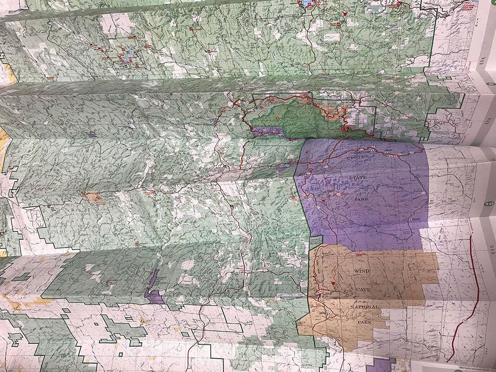
The map is a recreation reference, not a topographic trail map. It shows the things you need to find your way around the forest: paved and unpaved roads, hiking and OHV trails, campgrounds, picnic sites, fishing access, scenic byways, ranger district boundaries, and the major attractions inside the forest (Spearfish Canyon, Pactola Reservoir, Sylvan Lake, Black Elk Peak, the Mickelson Trail, the Centennial Trail). Shaded relief gives you a feel for the terrain, but there are no contour lines.
What it covers
The map covers the entire Black Hills National Forest on one sheet. Recreation features called out on the map include:
- Approximately 310 miles of hiking, biking, equestrian, and OHV trails
- About 350 miles of designated snowmobile trails (winter use)
- Developed campgrounds and dispersed camping zones
- Picnic areas, boat ramps, and fishing access
- Scenic byways including Spearfish Canyon, Needles Highway, and Iron Mountain Road corridors that pass through forest land
- Ranger district boundaries: Bearlodge, Northern Hills, Mystic, and Hell Canyon
- Forest Service road numbers for navigation off the paved highways
The recreation map is what you want for trip planning and general orientation in the forest. It is not the right tool for two specific use cases:
- Topographic detail. If you need contour lines and elevation data for off-trail navigation, the National Geographic Trails Illustrated maps for the Black Hills (North #751, South #238) are 1:70,000 scale with full topo. We carry those as well.
- Motor Vehicle Use designations. The 2017 recreation map predates the current Motor Vehicle Use Map (MVUM) updates. For street-legal and OHV designations on specific forest roads and trails, download the current free MVUM PDFs from the Black Hills National Forest maps page. The MVUM is the legal authority for motorized travel on the forest and changes more often than the printed recreation map.
Specifications
| Field | Value |
|---|---|
| Title | Black Hills National Forest Recreation Map |
| Edition / printing year | 2017 |
| Publisher | USDA Forest Service, Rocky Mountain Region (R2) |
| ISBN-13 | 9781628111149 |
| Scale | 1:90,000 |
| Format | Folded, two-sided, self-cover |
| Folded dimensions | 10″ x 5″ x 1″ |
| Weight | 4.3 oz |
| Paper | Recyclable mixed paper (not waterproof) |
| Topography | Shaded relief only (no contour lines) |
| Coverage | Black Hills National Forest, SD and WY (about 1.25 million acres) |
Who is this for?
Visitors who want one folded map that covers the whole forest at a glance. It is the right map for planning a trip, getting oriented at a trailhead, finding a campground, or following Forest Service road numbers off the main highways. The price is friendly enough to keep one in the glove box of every vehicle in your group.
Hunters, OHV riders, and backcountry hikers usually pair this map with the free MVUM PDF and a topographic map. The recreation map handles the big picture. The MVUM tells you which specific roads and trails are open to motorized use this season. A topo map (like Trails Illustrated #751 and #238) gives you the elevation detail for off-trail or long backcountry routes.
It is also a good first map for someone moving to the area or planning a multi-week regional trip. The whole forest on one sheet is hard to get any other way.
Frequently asked questions
Is this map waterproof?
No. This 2017 USFS recreation map is printed on standard recyclable mixed paper. If you want a waterproof and tear-resistant Black Hills map, look at the National Geographic Trails Illustrated maps (#751 North, #238 South), which are printed on synthetic “Backcountry Tough” paper.
Does this map have topographic contour lines?
No. This is a recreation reference map with shaded relief only. For contour-line topographic detail, use the National Geographic Trails Illustrated series (1:70,000) or USGS quadrangle maps.
What’s the scale?
1:90,000. That is broad enough to show the whole 1.25 million acre forest on a single folded sheet, but coarser than a topo trail map. Useful for trip planning and road navigation, less useful for a precise foot-by-foot off-trail route.
Does the map show current Motor Vehicle Use designations?
The MVU areas shown on this 2017 printing may be out of date. The Forest Service publishes the current MVUM as a free downloadable PDF at fs.usda.gov/r02/blackhills/maps-guides. The MVUM is the legal authority for motorized travel on the forest and supersedes any printed map.
Does it cover Mount Rushmore, Wind Cave, and Jewel Cave?
The map shows the surrounding national forest land and the road network that connects to these sites, but the parks themselves are managed by the National Park Service and have their own visitor maps. Wind Cave National Park and Jewel Cave National Monument are surrounded by the national forest, so this map is useful context for getting between them. Mount Rushmore is a National Memorial inside the forest’s footprint.
What’s the difference between the USFS recreation map and the National Geographic Trails Illustrated maps?
The USFS recreation map (this one) covers the whole forest on one sheet at 1:90,000 with shaded relief and a recreation focus. The Trails Illustrated maps are split into a North sheet (#751) and a South sheet (#238) at 1:70,000, with full topographic contour lines and waterproof paper. Most people who hike or ride the Black Hills regularly own both.
Does buying this support national parks?
Yes. BHPFA is the official nonprofit partner of Wind Cave National Park, Jewel Cave National Monument, Scotts Bluff National Monument, and Agate Fossil Beds National Monument, as well as the Black Hills National Forest and Nebraska National Forests & Grasslands. Proceeds from every purchase support education programs, conservation projects, and visitor services at these sites.
Where can I buy this map in person?
We carry it at the Wind Cave National Park visitor center store and the Jewel Cave National Monument visitor center store. The Black Hills National Forest visitor information centers also stock USFS recreation maps. Online orders ship from our South Dakota warehouse.
Every Purchase Makes a Difference
When you shop with Black Hills Parks & Forests Association, you are directly funding:
- Education programs — nature workshops, Junior Ranger activities, and homeschool adventures for kids across the Black Hills
- Trail maintenance — keeping hiking trails safe and accessible at Wind Cave, Jewel Cave, and the Black Hills National Forest
- Visitor services — park store operations, interpretive programs, and the staff who help millions of visitors each year
- Conservation — supporting the long-term health of public lands in the Black Hills and Nebraska
BHPFA is the official nonprofit partner of the National Park Service and U.S. Forest Service in the Black Hills region. We have supported these public lands since 1946.
Additional information
| Weight | 4.3 oz |
|---|---|
| Dimensions | 10 × 5 × 1 in |
| Brand | U.S. Forest Service |
| Publisher / Manufacturer | USDA Forest Service, Rocky Mountain Region |
| ISBN | 9781628111149 |
| Year Published | 2017 |
| Dimensions | 10" x 5" x 1" folded |
| Weight | 4.3 oz |
| Material | Recyclable mixed paper, two-sided self-cover |
| Map Scale | 1:90,000 |
| Map Coverage Area | Black Hills National Forest, South Dakota and Wyoming |
| Waterproof | No |
| Tear-Resistant | No |
| Country of Origin | United States |
Note on International Orders
Some countries charge import duties, VAT, or handling fees on delivery. These are set by your local government and are not included in our checkout total. Customers are responsible for paying any such charges before receiving their package.