
Real-time rates straight from USPS. No mark-ups, ever. Every dollar we don’t spend on so-called ‘free shipping’ fuels research, internships, and trail work in your favorite parks / forests.
Become a BHPFA member for $30 a year and we’ll fire a digital membership code into your inbox in seconds. Paste that code at checkout and save 15%.
Flash your membership card at hundreds of nonprofit park stores nationwide for 10% off.
Park rangers and US Forest Service interpreters hand-pick every title, tee, and trinket, so you’re getting facts not fluff. And your purchase keeps them on the front lines.
Description
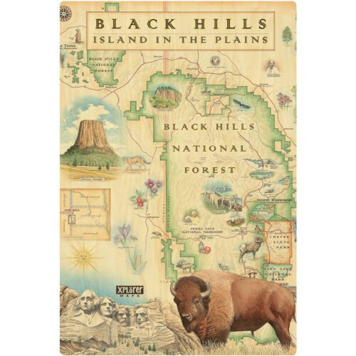
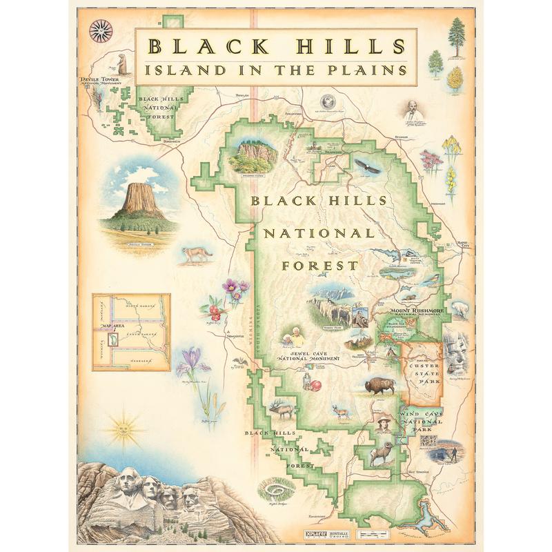
Come face to face with our nation’s history and marvel at the majestic beauty of the Black Hills of South Dakota (and a touch of Wyoming) in this Black Hills National Forest Map.
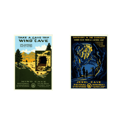
The four iconic presidents of Mt. Rushmore (Washington, Jefferson, Roosevelt and Lincoln) overlook a National Forest as rich in natural resources as history. Encompassing the Black Hills, the Black Mountains and the Bear Lodge Mountains of Wyoming, this Black Hills National Forest map also includes Wind Cave National Park and Custer State Park.
The Black Hills rise from adjacent grasslands into a Ponderosa Pine forest. Described as an “Island in the Plains,” the Forest has diverse wildlife and plants reaching from the Eastern forests to the Western plains. Elk, Mule Deer, Pronghorn Antelope, Mountain Lions and Bighorn Sheep roam the landscape while eagles, falcons and bats take to the sky and wildflowers grace the landscape. From the top of Devil’s tower to the depths of the Wind caves, it’s all gorgeously illustrated in the Xplorer Maps exclusive Black Hills National Forest Map.
The Black Hills National Forest Map is 18″ wide x 24″ tall.
Additional information
| Weight | 19.8 oz |
|---|---|
| Dimensions | 19 × 2.5 × 2.5 in |
| xplorer map | Map, Note card, Sweat Bandoo, Puzzle |