
National Parks of the United States Map by National Geographic
$14.95
Only 1 left in stock
Shipping calculated in cart/checkout: Shipping rates for first items start at $7, calculated based on weight of total order.
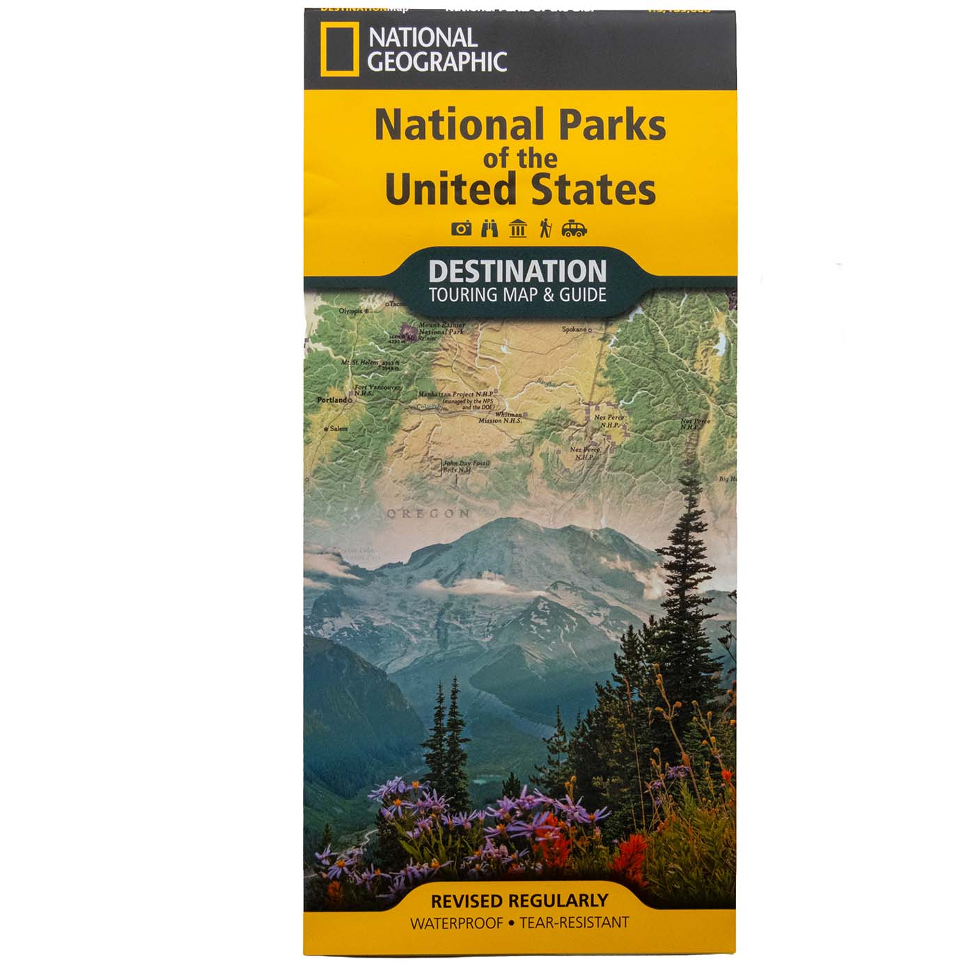
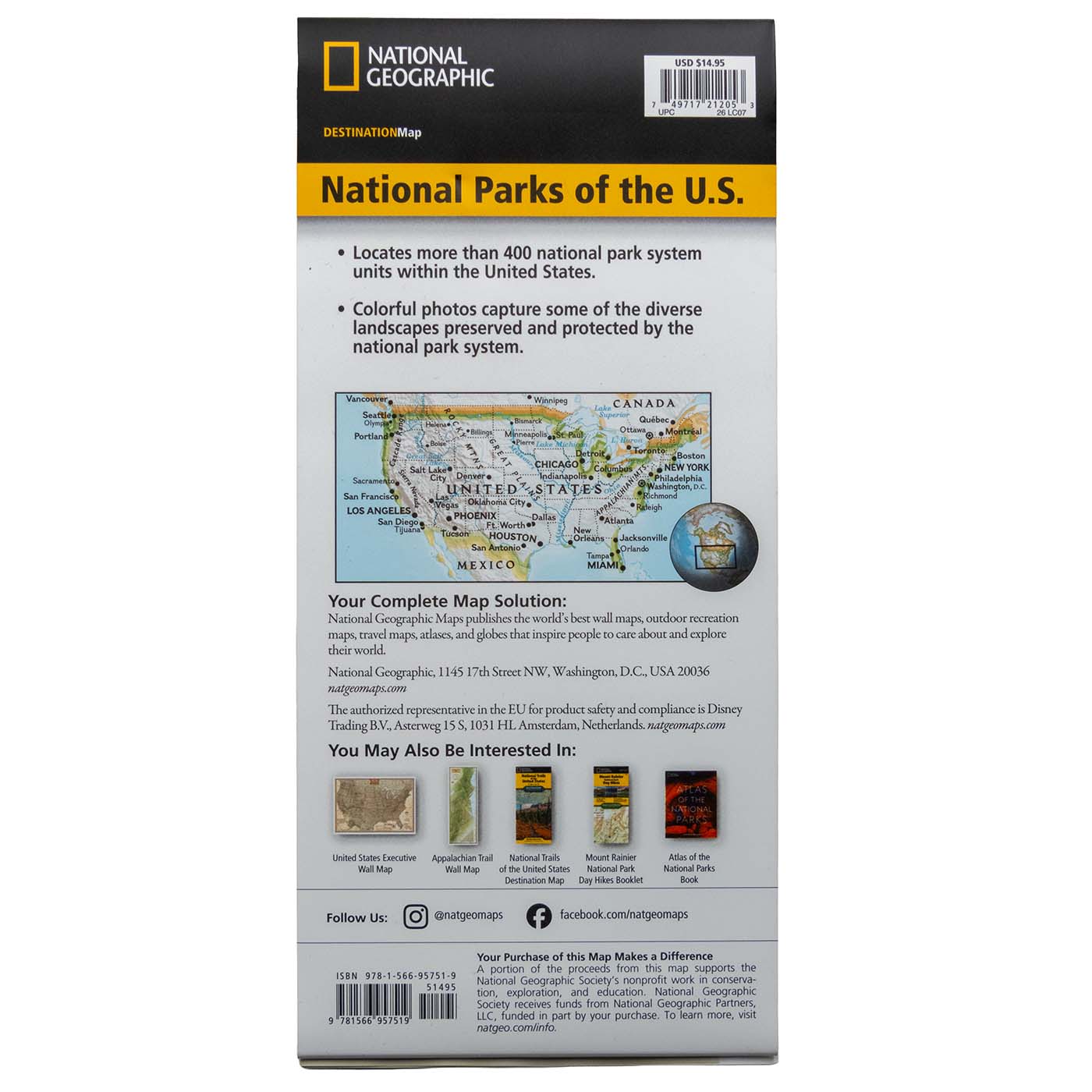
The official National Geographic Destination Map of the United States national parks, printed on waterproof, tear-resistant synthetic paper so it holds up on the road or on the trail.
- Coverage: Nearly 400 national park service units across all 50 states
- Folded size: 4.25″ x 9.25″ (fits a jacket pocket or glove box)
- Unfolded size: 37.75″ x 25.5″
- Scale: 1:5,200,000
- Paper: Waterproof and tear-resistant synthetic paper
- Published by National Geographic Maps, ISBN 9781566957519
- Proceeds support education, conservation, and visitor services at BHPFA partner parks and forests.
Only 1 left in stock
60-day returns · Ships from South Dakota via USPS
National Parks of the United States Map by National Geographic
$14.95
Only 1 left in stock
Shipping calculated in cart/checkout: Shipping rates for first items start at $7, calculated based on weight of total order.
The official National Geographic Destination Map of the United States national parks, printed on waterproof, tear-resistant synthetic paper so it holds up on the road or on the trail.
- Coverage: Nearly 400 national park service units across all 50 states
- Folded size: 4.25″ x 9.25″ (fits a jacket pocket or glove box)
- Unfolded size: 37.75″ x 25.5″
- Scale: 1:5,200,000
- Paper: Waterproof and tear-resistant synthetic paper
- Published by National Geographic Maps, ISBN 9781566957519
- Proceeds support education, conservation, and visitor services at BHPFA partner parks and forests.
Only 1 left in stock
60-day returns · Ships from South Dakota via USPS
Real USPS rates, no markup. The money we save funds trail crews and internships.
Join BHPFA for $30 a year -> get your code by email in seconds. -> Use it at checkout today. Show your card at hundreds of nonprofit park stores nationwide for 10% off.
Every item is selected or approved by rangers and staff. Your purchase keeps them on the front lines.
Real USPS rates, no markup. The money we save funds trail crews and internships.
Join BHPFA for $30 a year -> get your code by email in seconds. -> Use it at checkout today. Show your card at hundreds of nonprofit park stores nationwide for 10% off.
Every item is selected or approved by rangers and staff. Your purchase keeps them on the front lines.
Description
What is this map?
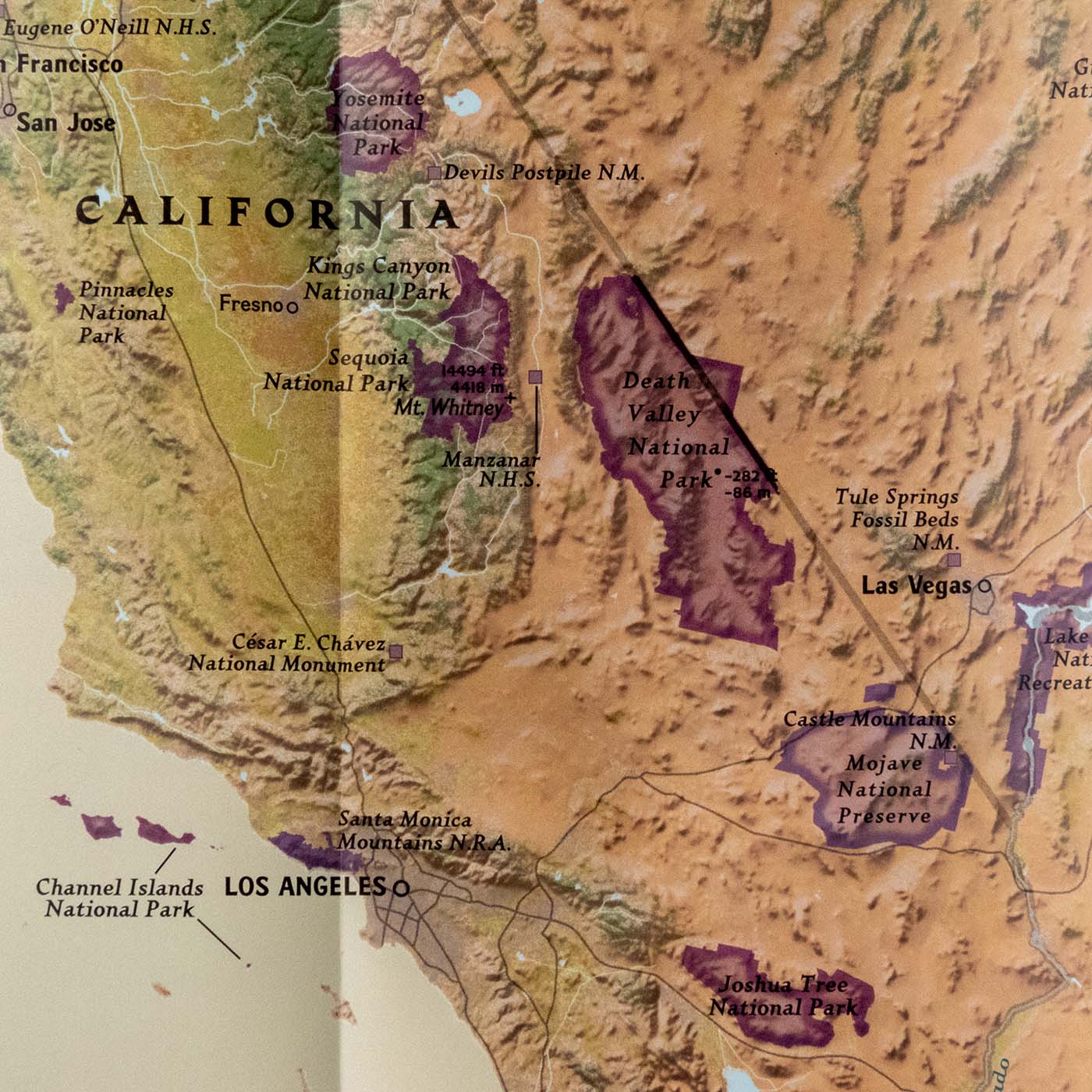
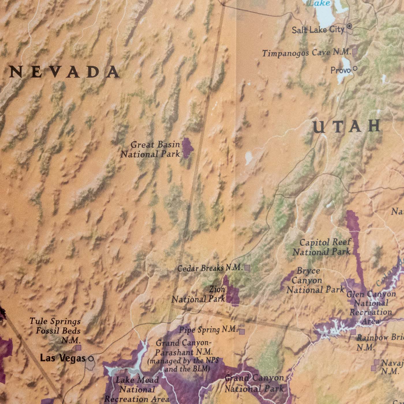
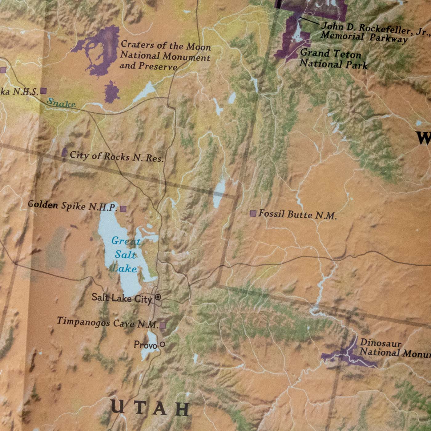
This is National Geographic’s Destination Map of the United States national parks. It covers nearly 400 national park service units, from the familiar big names to the smaller historic sites, recreation areas, and seashores that rarely make the highlight reel. The cartography uses subtle earth-tone shading, mountain relief, and intricately drawn river systems so you can orient yourself on the landscape rather than stare at a blank background.
The map is published by National Geographic Maps, the same division behind the Trails Illustrated topo series. It is printed on durable synthetic paper that is waterproof and tear-resistant, which matters when you are pulling it in and out of a wet rain jacket pocket at Scotts Bluff or passing it around the car on a Black Hills road trip.
What’s included
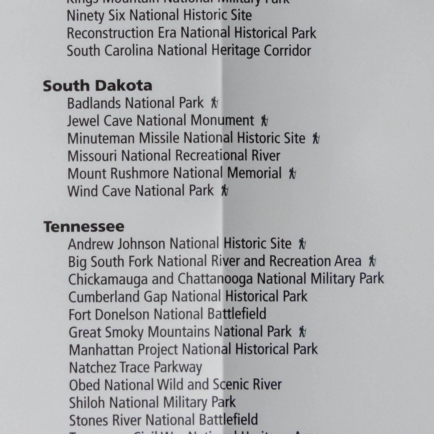
The map folds down to 4.25″ x 9.25″ for pocket or glove-compartment storage and opens to a full 37.75″ x 25.5″ sheet. Along the edges you will find a state-sorted index of all park service units, so you can quickly cross-reference a park name with its location on the map. Photos of representative landscapes are scattered across the face of the map. Scale is 1:5,200,000.
Specifications
| Field | Value |
|---|---|
| Publisher | National Geographic Maps |
| ISBN-13 | 9781566957519 |
| Year | 2018 |
| Folded size | 4.25″ x 9.25″ |
| Unfolded size | 37.75″ x 25.5″ |
| Scale | 1:5,200,000 |
| Paper | Waterproof, tear-resistant synthetic paper |
| Weight | approx. 3.2 oz |
| Coverage | Nearly 400 national park service units, all 50 states |
Who is this for?
If you are planning a national parks road trip and want a single physical reference that covers the whole system, this map does that. You can spread it out on a picnic table, mark routes, and see relative distances between parks in a way that a phone screen does not allow.
It is also a practical gift for anyone visiting a BHPFA partner site. A visitor stopping at Scotts Bluff National Monument on their first drive through the Nebraska panhandle can use this map to identify which other NPS units are within a day’s drive, including Agate Fossil Beds National Monument just 65 miles away.
Park rangers and frequent visitors use this map as a quick reference or a planning tool for multi-park itineraries. It fits in a back pocket and costs less than a full guidebook.
Frequently asked questions
How many parks does this map cover?
Nearly 400 national park service units, which includes national parks, monuments, recreation areas, historic sites, seashores, parkways, and other designations within the NPS system.
What size does it open to?
The map opens to 37.75″ x 25.5″. It folds back down to 4.25″ x 9.25″, which fits in a standard jacket pocket or a glove compartment.
Is it waterproof?
Yes. The map is printed on synthetic paper that is both waterproof and tear-resistant. It can get wet and dry out without damage.
What scale is used?
The scale is 1:5,200,000. This gives you broad national coverage on one sheet. It is not intended for trail navigation; for detailed trail maps of specific parks, National Geographic’s Trails Illustrated series covers individual parks.
Does buying this support national parks?
Yes. BHPFA is the official nonprofit partner of Wind Cave National Park, Jewel Cave National Monument, Scotts Bluff National Monument, and Agate Fossil Beds National Monument, as well as the Black Hills National Forest and Nebraska National Forests & Grasslands. Proceeds from every purchase support education programs, conservation projects, and visitor services at these sites.
Where can I find this map at BHPFA partner sites?
This map is carried at the Scotts Bluff National Monument visitor center store, the Wind Cave National Park visitor center store, and the Jewel Cave National Monument visitor center store. It is also available online with shipping from our South Dakota warehouse.
Is this a current edition?
The edition in stock is the 2018 National Geographic Destination Map (ISBN 9781566957519). If you need to confirm whether a newer edition is available, contact us before ordering.
Does this map include the Black Hills National Forest?
The map covers National Park Service units. The Black Hills National Forest is a US Forest Service site, not NPS, so it is not included in the NPS listings. However, the map does show Wind Cave National Park and Jewel Cave National Monument, both of which are in the Black Hills region.
Every Purchase Makes a Difference
When you shop with Black Hills Parks & Forests Association, you are directly funding:
- Education programs — nature workshops, Junior Ranger activities, and homeschool adventures for kids across the Black Hills
- Trail maintenance — keeping hiking trails safe and accessible at Wind Cave, Jewel Cave, and the Black Hills National Forest
- Visitor services — park store operations, interpretive programs, and the staff who help millions of visitors each year
- Conservation — supporting the long-term health of public lands in the Black Hills and Nebraska
BHPFA is the official nonprofit partner of the National Park Service and U.S. Forest Service in the Black Hills region. We have supported these public lands since 1946.
Additional information
| Weight | 3 oz |
|---|---|
| Brand | National Geographic |
| Publisher / Manufacturer | National Geographic Maps |
| ISBN | 9781566957519 |
| Year Published | 2018 |
| Dimensions | 4.25" x 9.25" folded; 37.75" x 25.5" unfolded |
| Weight | 3.2 oz |
| Map Scale | 1:5,200,000 |
| Map Coverage Area | United States national parks (nearly 400 NPS units) |
| Waterproof | Yes |
| Tear-Resistant | Yes |
Note on International Orders
Some countries charge import duties, VAT, or handling fees on delivery. These are set by your local government and are not included in our checkout total. Customers are responsible for paying any such charges before receiving their package.