
Real-time rates straight from USPS. No mark-ups, ever. Every dollar we don’t spend on so-called ‘free shipping’ fuels research, internships, and trail work in your favorite parks / forests.
Become a BHPFA member for $30 a year and we’ll fire a digital membership code into your inbox in seconds. Paste that code at checkout and save 15%.
Flash your membership card at hundreds of nonprofit park stores nationwide for 10% off.
Park rangers and US Forest Service interpreters hand-pick every title, tee, and trinket, so you’re getting facts not fluff. And your purchase keeps them on the front lines.
Description
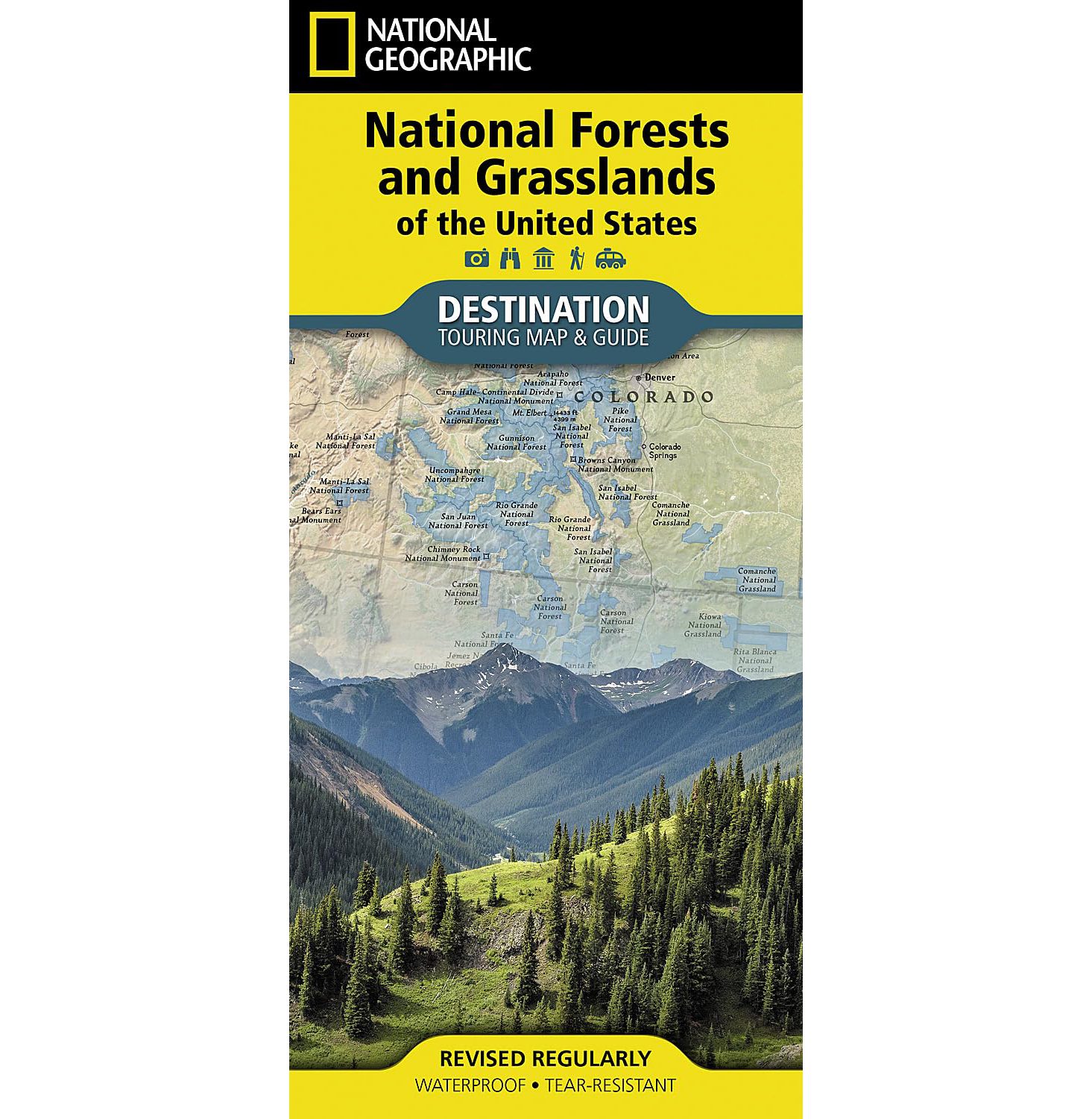
• Waterproof • Tear-Resistant • Topographic Map
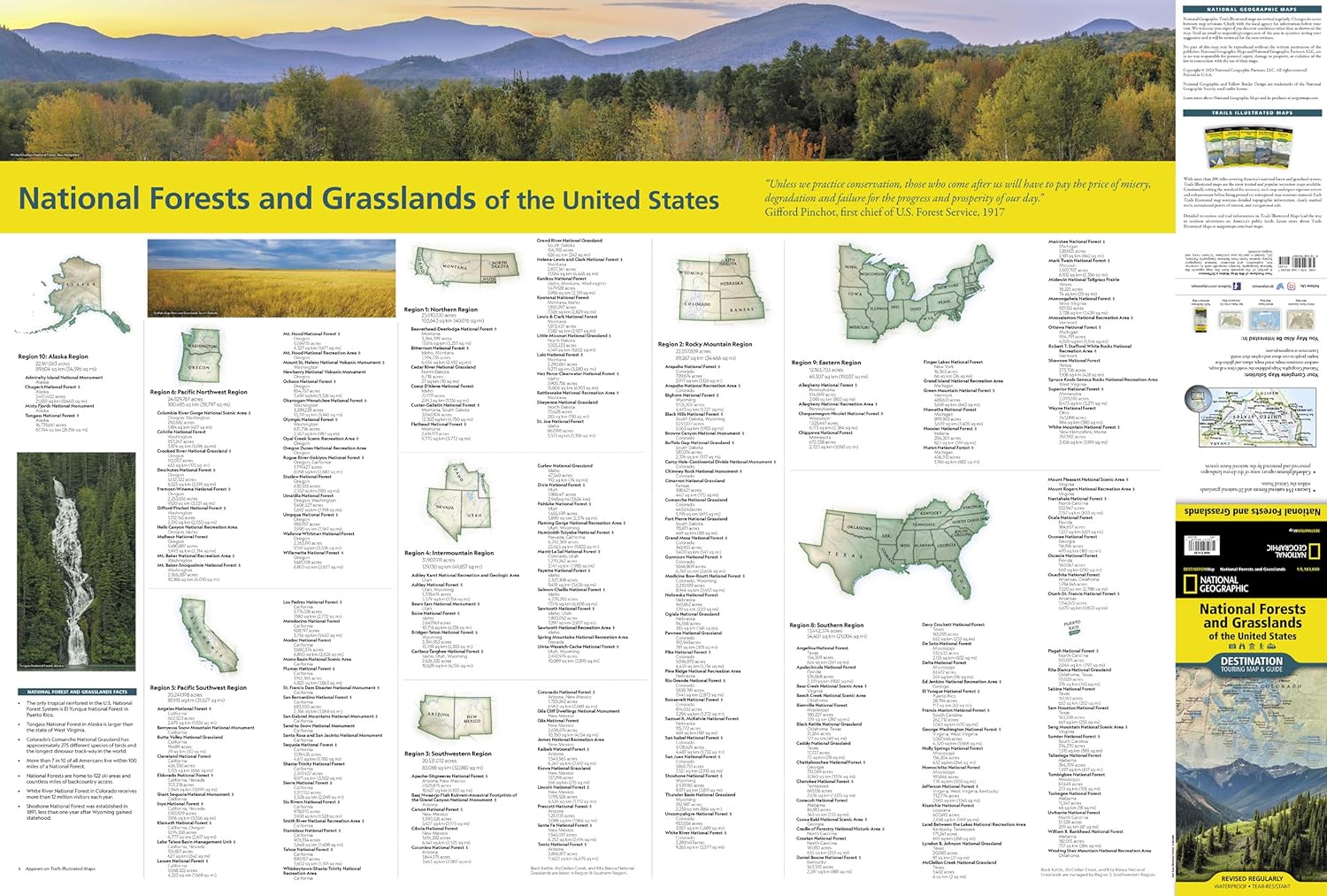
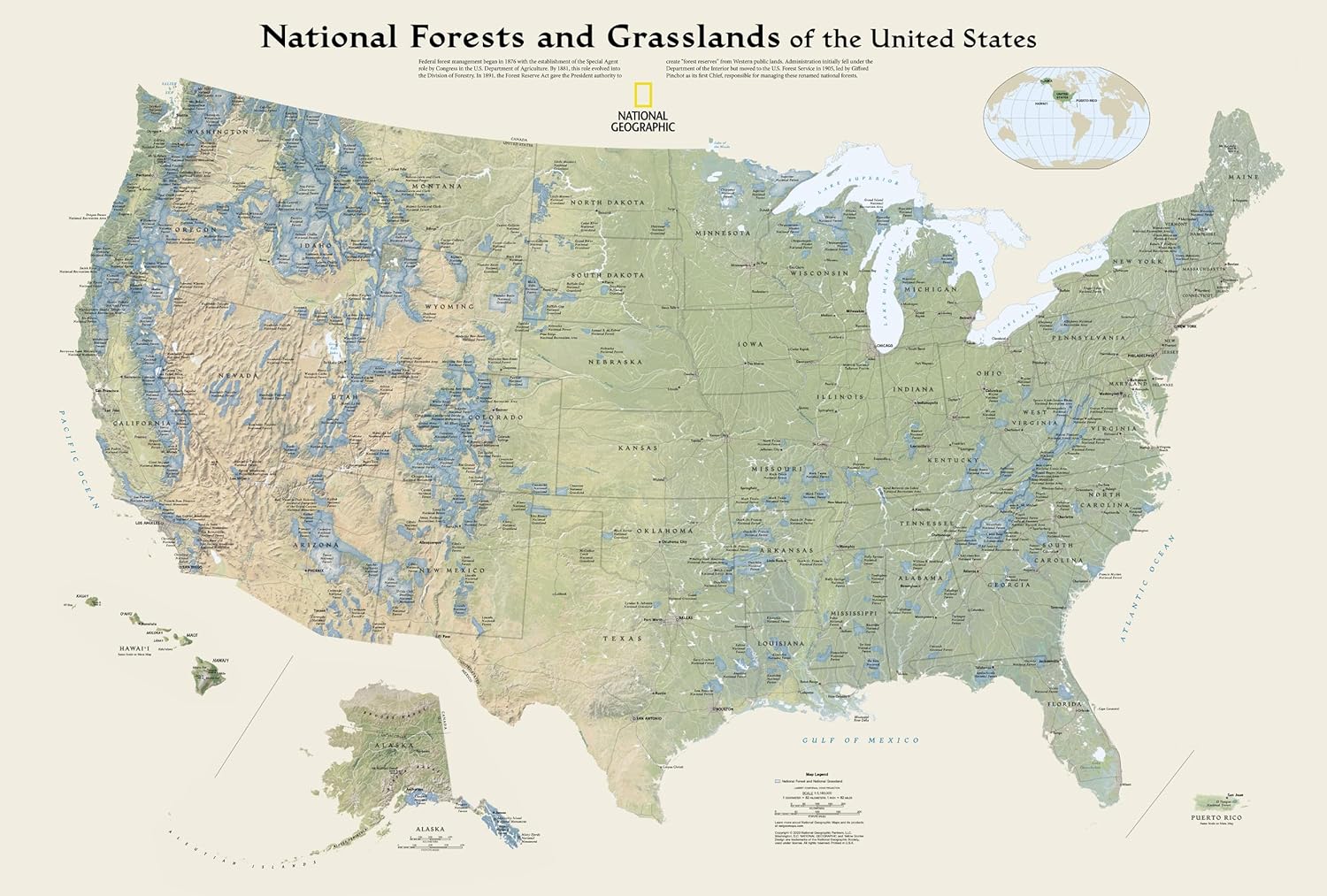
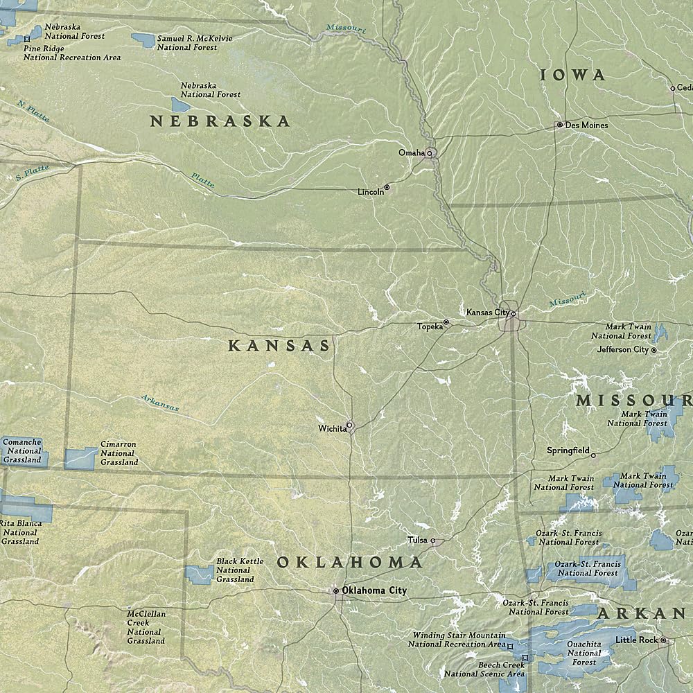
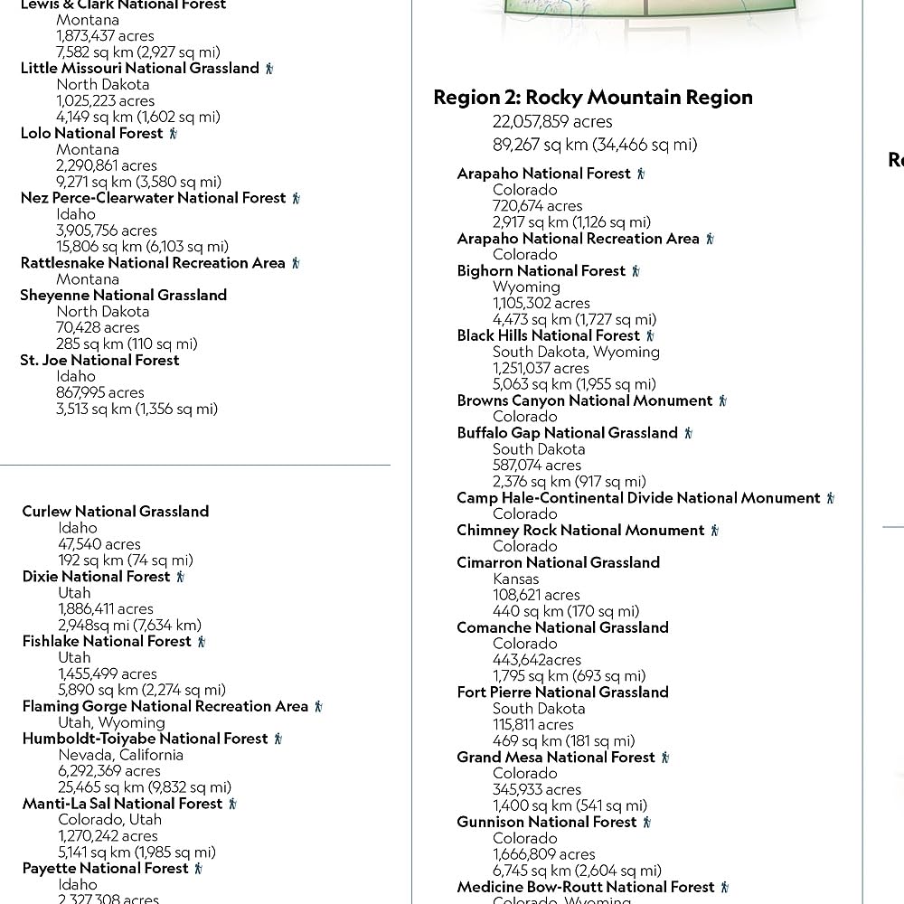
National Geographic’s Destination Map of National Forests and Grasslands of the United States highlights the 154 national forests and 20 national grasslands across America. The country is represented in subtle earth-tones with shaded mountain relief and intricately drawn river systems. Photos capture some of the diverse landscapes preserved and protected by the national forest system. A list of all forest service and grasslands units, sorted by region, is also included to help you find the closest recreational opportuinity.
Every Destination Map is printed on durable synthetic paper, making them waterproof, tear-resistant and tough — capable of withstanding the rigors of any kind of travel.
- Map Scale = 1:5,200,000
- Sheet Size = 37.75″ x 25.5″
- Folded Size = 4.25″ x 9.25″
Additional information
| Weight | 3 oz |
|---|